The Future El Camino Real – Bikes Or No Bikes?
[vc_row][vc_column width=”1/1″][vc_column_text]
NOTE: Download the revised version of this post.
[/vc_column_text][/vc_column][/vc_row][vc_row][vc_column width=”1/1″][vc_column_text]
View comments on the Nextdoor neighborhood network.
Also view the post How To Make Menlo Park More Bike-Friendly.
[/vc_column_text][/vc_column][/vc_row][vc_row][vc_column width=”1/1″][vc_column_text]
On February 19 the City of Menlo Park held a community workshop to update residents on the status of the El Camino Real Corridor Study. “This study is reviewing potential transportation and traffic safety improvements to El Camino Real between Sand Hill Road and Encinal Avenue.” I strongly encourage Menlo Park residents to become informed about this study and express their views as the choices our city makes about future lane configurations on El Camino Real will dramatically impact the safety of cyclists and convenience of drivers.
View my impressions of the workshop by downloading an update of this post.
[/vc_column_text][/vc_column][/vc_row][vc_row][vc_column width=”1/1″][vc_column_text]
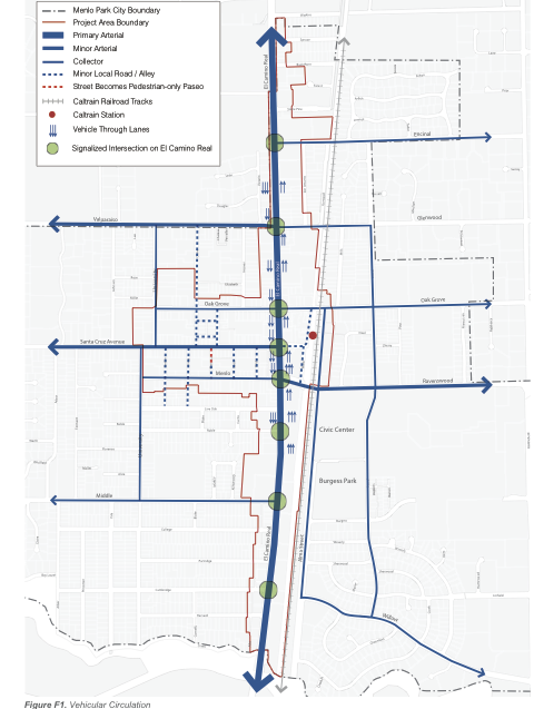
Current Situation – Vehicle Traffic on El Camino Real
El Camino Real is a state highway that runs through Menlo Park and serves as the primary north-south vehicle route that parallels Highways 101 and 280. It is heavily traveled because of the large number of workers who commute through Menlo Park who do not have alternatives like Foothill Expressway and Alma Street in Palo Alto, and there is no convenient east-west access to both 101 and 280 from El Camino Real between Page Mill Expressway and Woodside Road (Highway 84). The average daily traffic at the north end of El Camino is 34,600 vehicles; at the south end it is 46,700 vehicles.
[/vc_column_text][/vc_column][/vc_row][vc_row][vc_column width=”1/1″][vc_single_image image=”2348″ alignment=”center” border_color=”grey” img_link_large=”yes” img_link_target=”_self” img_size=”full”][/vc_column][/vc_row][vc_row][vc_column width=”1/1″][vc_separator color=”grey”][/vc_column][/vc_row][vc_row][vc_column width=”1/1″][vc_column_text]
Existing Vehicle Lane Configurations
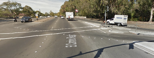
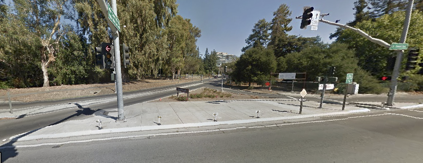
To better understand the impact of the three alternatives one needs to know what vehicle lane configurations exist today and the different classifications for bike routes.
[/vc_column_text][/vc_column][/vc_row][vc_row][vc_column width=”1/1″][vc_gallery type=”image_grid” interval=”3″ images=”2330,2331,2332″ onclick=”link_image” custom_links_target=”_self” img_size=”medium”][/vc_column][/vc_row][vc_row][vc_column width=”1/1″][vc_column_text]
Current North-South Bike Routes on El Camino Real and Nearby
Few cyclists ride on El Camino Real in either Menlo Park or in adjacent Atherton and Palo Alto as there are no separate bike lanes. Likely less than 50 riders use this route today, and there is no reliable estimate of the number of riders who would ride on El Camino Real IF a separate bike lane were built in Menlo Park.
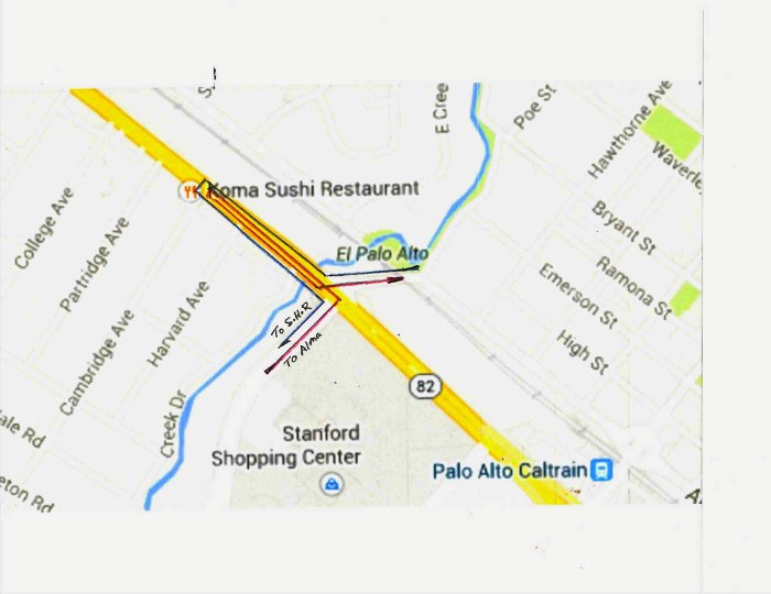
Cyclists currently have a number of north-south routes close to El Camino Real.
- They can travel on Alma Street from Sand Hill Road to Ravenswood and Oak Grove where they can either return to El Camino Real or use nearby Laurel Avenue to reach Encinal. And from Encinal return to El Camino Real.
- They can travel from Sand Hill Road to Laurel Street (via Alma) and continue to Encinal. And from Encinal return to El Camino Real.
- While traveling on El Camino Real between Encinal and Watkins is less than ideal, there is little parking along either side. This is a plus for cyclists.
[/vc_column_text][/vc_column][/vc_row][vc_row][vc_column width=”1/1″][vc_separator color=”grey”][/vc_column][/vc_row][vc_row][vc_column width=”1/1″][vc_column_text]
Bike Lane Classifications
[/vc_column_text][/vc_column][/vc_row][vc_row][vc_column width=”1/1″][vc_message color=”alert-info” style=”rounded”]
Class I Bikeway (Bike Path) provides a completely separate right-of-way and is designated for the exclusive use of bicycles and pedestrians with vehicle and pedestrian cross-flow minimized.
[/vc_message][/vc_column][/vc_row][vc_row][vc_column width=”1/1″][vc_separator color=”grey”][/vc_column][/vc_row][vc_row][vc_column width=”1/1″][vc_column_text]
Specific Plan & El Camino Real Corridor Study Bike Routes
The Specific Plan proposed two different north-south options for adding bike lanes to El Camino Real, and both would reduce the number of vehicle lanes to two in each direction for its entire length.
[/vc_column_text][/vc_column][/vc_row][vc_row][vc_column width=”1/1″][vc_gallery type=”image_grid” interval=”3″ images=”2325″ onclick=”link_image” custom_links_target=”_self” img_size=”large”][/vc_column][/vc_row][vc_row][vc_column width=”1/1″][vc_separator color=”grey”][/vc_column][/vc_row][vc_row][vc_column width=”1/1″][vc_column_text]
Three Alternatives In El Camino Real Corridor Study
Alternative 1: Make El Camino Real three-lanes in both direction and create a mostly Class III bike route that parallels El Camino and relies on Alma Street. This route
is one recommended in the Specific Plan.
• Sand Hill Road to Ravenswood via Alma Street – Existing Class II
• Ravenswood to Oak Grove via Alma Street – Planned
• Oak Grove to Glenwood via Greenheart property – Planned
• Glenwood to Encinal via Garwood – Planned
• Encinal to El Camino Real – Planned
• El Camino North to Watkins – Planned Class II
Alternative 2: Adds a single Class II/Minimum Class III bike lane to each side of El Camino Real for its entire length. Vehicle traffic would be reduced to two lanes in each direction. This alternative is recommended in the Specific Plan.
Alternative 3: Adds a Class I bike lane to each side of El Camino Real for its entire length. This includes a physical separation between bike and vehicle lanes. This alternative is not recommended in the Specific Plan. Rather, a Class II bike lane is recommended.
[/vc_column_text][/vc_column][/vc_row][vc_row][vc_column width=”1/1″][vc_single_image image=”2333″ alignment=”center” border_color=”grey” img_link_large=”yes” img_link_target=”_self” img_size=”medium”][/vc_column][/vc_row][vc_row][vc_column width=”1/1″][vc_single_image image=”2335″ alignment=”center” border_color=”grey” img_link_large=”yes” img_link_target=”_self” img_size=”medium”][/vc_column][/vc_row][vc_row][vc_column width=”1/1″][vc_single_image image=”2337″ alignment=”center” border_color=”grey” img_link_large=”yes” img_link_target=”_self” img_size=”medium”][/vc_column][/vc_row][vc_row][vc_column width=”1/1″][vc_separator color=”grey”][/vc_column][/vc_row][vc_row][vc_column width=”1/1″][vc_message color=”alert-info” style=”rounded”]
My Personal Views:
I strongly prefer leaving El Camino Real “as is” and creating a safe and convenient bike route that stays off this multi-lane highway. Cyclists can have a convenient and safe north-south route that parallels El Camino and largely relies on nearby Alma Street, Garwood Street and a connection through the private Greenheart property at 1300 El Camino Real. The City can revisit the option of expanding ECR to 3 lanes in each direction once the Greenheart and Stanford projects are completed and start with a six to nine month test.
- Highway 82 already carries about 35,000 daily vehicles north of Ravenswood and about 45,000 on the south end. If the north end of El Camino Real were 6 lanes there would be about 6000 vehicles per lane per day; and at the south end about 7500 vehicles per lane per day.
- Additional traffic will be generated by the planned Greenheart and Stanford multiuse developments, and the actual impact will no be known until these are completed four to five years from now. Together the two projects will add about 700 new residents and 1500 new workers. Beyond this, new developments already underway in Redwood City and on the north side of Stanford University campus will create additional “pass through” traffic.
- The total number of cyclists who would actually ride on El Camino Real for any significant distance would likely be small (100 to 125 per day???) does not justify throttling thousands of vehicles.
- Once a pedestrian/bike crossing is build under the tracks near Middle Avenue cyclists will have another convenient route to Alma Street. Until then, Menlo Park should encourage cyclists to share the sidewalks on El Camino Real between Sand Hill Road and Ravenswood, especially on the east side where there is little foot traffic.
- Finally, few cyclists ride on El Camino Real in either Atherton or Palo Alto so a Menlo Park bike lane would be an anomaly.
[/vc_message][/vc_column][/vc_row]


